
At MapStand, our mission is to make trusted energy geospatial information easy to discover, understand, and share.
Today we’re excited to announce that MapStand is now live on ArcGIS Online, opening the door to secure, real‑time collaboration with organisations around the world.
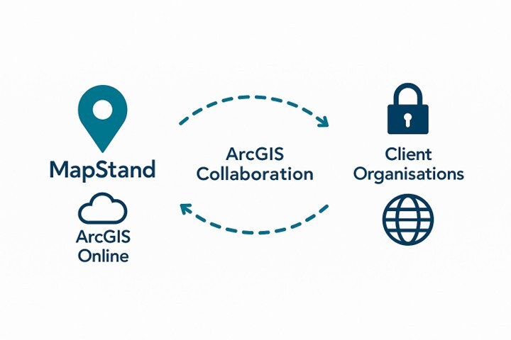
What is ArcGIS Collaboration?
As an Esri Bronze partner, MapStand gains exposure on Esri’s partner directory and the ArcGIS Marketplace. This opens the door to new clients actively seeking spatial energy data and apps.
ArcGIS Collaboration is Esri’s framework for distributed collaboration. It allows two or more ArcGIS organisations, whether ArcGIS Online, ArcGIS Enterprise, or a mix of both, to securely synchronise layers, maps, apps, and files.
.jpg?width=784&height=200&name=1692860782175%20(1).jpg) Content stays in sync on a schedule that you choose, so every team will always be equipped with the latest version - complete with metadata, symbology, and thumbnails.
Content stays in sync on a schedule that you choose, so every team will always be equipped with the latest version - complete with metadata, symbology, and thumbnails.
- One‑way or two‑way sync of feature layers, tile layers, web maps, apps, and files.
- Group‑based security; only members of invited collaboration groups can view or edit the content.
- Automated versioning so you never overwrite work in progress.
- Near real‑time updates driven by scheduled replication.
Why does this matter for MapStand users?
By leveraging ArcGIS Collaboration, MapStand can push our curated global energy datasets straight into your own ArcGIS Online or ArcGIS Enterprise environment. This means you'll have access to:
- Streamlined workflows: no more manual downloads or custom ETL scripts.
- Authoritative data at source: you see exactly what we see: up‑to‑date licence rounds, wells, fields, pipelines, offshore wind leases, and more.
- Overlay with your proprietary layers: enrich MapStand content with internal operational data to accelerate analysis and decision‑making.
- Offline & mobile ready: once the data is in your organisation, it works in ArcGIS Field Maps, Dashboards, Insights, and any other ArcGIS app that you already use.
How does the collaboration work for MapStand users?
The process for users is really simple. Start with the following steps:
1. We create a collaboration workspace. MapStand hosts the workspace in our ArcGIS Online organisation.
2. You accept the invite. We send a secure collaboration invitation code that your ArcGIS administrator accepts.
3. Select the content. Together, we will agree on which layers, maps, or files you need.
4. Schedule the sync. Daily, weekly, or real‑time - pick the cadence that best suits your project.
5. Work as usual. The content appears in a dedicated group in your organisation. Use, analyse, and share it with confidence. How to get started
Ready to get started? We can't wait to assist you. Simply...
- Email support@mapstand.com with the subject line “ArcGIS Collaboration request”.
- Tell us your ArcGIS organisation URL and a contact for the admin who will accept the invitation.
- Let us know which regions or themes you need first.
- We’ll set up the workspace, send you the invitation code, and guide your admin through the two‑minute acceptance workflow.
Join the conversation
We’d love to hear how ArcGIS Collaboration could streamline your workflows and how you're getting on during the process. Tag us on LinkedIn @MapStand
Together we can accelerate the energy transition—one map at a time.
Get in touch
If you'd like to discuss how we can support you with projects in 2025 and beyond, we'd love to hear from you. You can contact us here.